WK 5012 High Wall - Mountains - Biedermeiertal - Gutenstein,
freytag & berndt maps are available for many countries and regions in the world. In addition to the precise cartography each map also includes a lot of additional information about the region covered.
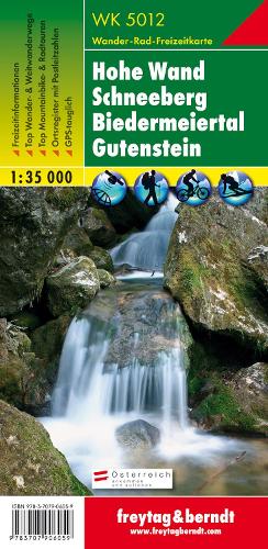
Thanks to the detailed digital cartography and the precise scales, freytag & berndt hiking maps are ideal companions for hiking, mountaineering and ski tours. The 'WK 5012 Hohe Wand - Schneeberg - Biedermeiertal - Gutenstein, hiking map 1:35,000' is revised regularly and contains updated information on hiking trails, cycle and mountain bike trails, huts, natural monuments, cultural sights and leisure facilities. On the back of the hiking map you will find a selection of the best hiking trails, cycle paths and mountain bike trails as well as a brief description of the individual communities and their leisure activities. (Language: German) Leisure information, hiking and long-distance hiking trails, mountain bike and cycling tours, register of places with postcodes, GPS-compatible, via ferrata, ski route, cross-country route, Nordic walking route; Region: Schneeberg, Hohe Wand, Schneebergland, Biedermeier Valley, Vienna Alps, industrial district, Lower Austria; Special themed hiking trails: Northern Alpine Trail, Pre-Alpine Trail, Lower Austrian State Circular Trail, Mariazeller Trail, Piestingtal Circular Trail, Waldmark Trail, Via Slavorum, Vienna Alpine Arch, Myra Falls and Kreuthsattel, Miesenbach Circular Trail, Hohe Wand and Unicorn Cave; Special cycle and mountain bike tours: Piestingtal cycle path (Biedermeier cycle path), Hohe Wand cycle path, Mühlradl cycle path, Triestingtal cycle path, Schneeberg route, Michaela DorCBeister route, Dürrnberg route, panorama round; Environment maps: WK 011, WK 012, WK 022, WK 023; Northern Alpine Trail, Pre-Alpine Trail, Lower Austrian State Circular Trail, Mariazeller Trail, Piestingtal Circular Trail, Waldmark Trail, Via Slavorum, Vienna Alpine Arch, Myra Falls and Kreuthsattel, Miesenbach Circular Hike, Hohe Wand and Unicorn Cave; Special cycle and mountain bike tours: Piestingtal cycle path (Biedermeier cycle path), Hohe Wand cycle path, Mühlradl cycle path, Triestingtal cycle path, Schneeberg route, Michaela DorCBeister route, Dürrnberg route, panorama round; Environment maps: WK 011, WK 012, WK 022, WK 023; Northern Alpine Trail, Pre-Alpine Trail, Lower Austrian State Circular Trail, Mariazeller Trail, Piestingtal Circular Trail, Waldmark Trail, Via Slavorum, Vienna Alpine Arch, Myra Falls and Kreuthsattel, Miesenbach Circular Hike, Hohe Wand and Unicorn Cave; Special cycle and mountain bike tours: Piestingtal cycle path (Biedermeier cycle path), Hohe Wand cycle path, Mühlradl cycle path, Triestingtal cycle path, Schneeberg route, Michaela DorCBeister route, Dürrnberg route, panorama round; Environment maps: WK 011, WK 012, WK 022, WK 023; Mühlradl cycle path, Triestingtal cycle path, Schneeberg route, Michaela DorCBeister route, Dürrnberg route, panorama circuit; Environment maps: WK 011, WK 012, WK 022, WK 023; Mühlradl cycle path, Triestingtal cycle path, Schneeberg route, Michaela DorCBeister route, Dürrnberg route, panorama circuit; Environment maps: WK 011, WK 012, WK 022, WK 023;
Product Information
Product Information
Shipping & Returns
Shipping & Returns
Description
freytag & berndt maps are available for many countries and regions in the world. In addition to the precise cartography each map also includes a lot of additional information about the region covered.
Thanks to the detailed digital cartography and the precise scales, freytag & berndt hiking maps are ideal companions for hiking, mountaineering and ski tours. The 'WK 5012 Hohe Wand - Schneeberg - Biedermeiertal - Gutenstein, hiking map 1:35,000' is revised regularly and contains updated information on hiking trails, cycle and mountain bike trails, huts, natural monuments, cultural sights and leisure facilities. On the back of the hiking map you will find a selection of the best hiking trails, cycle paths and mountain bike trails as well as a brief description of the individual communities and their leisure activities. (Language: German) Leisure information, hiking and long-distance hiking trails, mountain bike and cycling tours, register of places with postcodes, GPS-compatible, via ferrata, ski route, cross-country route, Nordic walking route; Region: Schneeberg, Hohe Wand, Schneebergland, Biedermeier Valley, Vienna Alps, industrial district, Lower Austria; Special themed hiking trails: Northern Alpine Trail, Pre-Alpine Trail, Lower Austrian State Circular Trail, Mariazeller Trail, Piestingtal Circular Trail, Waldmark Trail, Via Slavorum, Vienna Alpine Arch, Myra Falls and Kreuthsattel, Miesenbach Circular Trail, Hohe Wand and Unicorn Cave; Special cycle and mountain bike tours: Piestingtal cycle path (Biedermeier cycle path), Hohe Wand cycle path, Mühlradl cycle path, Triestingtal cycle path, Schneeberg route, Michaela DorCBeister route, Dürrnberg route, panorama round; Environment maps: WK 011, WK 012, WK 022, WK 023; Northern Alpine Trail, Pre-Alpine Trail, Lower Austrian State Circular Trail, Mariazeller Trail, Piestingtal Circular Trail, Waldmark Trail, Via Slavorum, Vienna Alpine Arch, Myra Falls and Kreuthsattel, Miesenbach Circular Hike, Hohe Wand and Unicorn Cave; Special cycle and mountain bike tours: Piestingtal cycle path (Biedermeier cycle path), Hohe Wand cycle path, Mühlradl cycle path, Triestingtal cycle path, Schneeberg route, Michaela DorCBeister route, Dürrnberg route, panorama round; Environment maps: WK 011, WK 012, WK 022, WK 023; Northern Alpine Trail, Pre-Alpine Trail, Lower Austrian State Circular Trail, Mariazeller Trail, Piestingtal Circular Trail, Waldmark Trail, Via Slavorum, Vienna Alpine Arch, Myra Falls and Kreuthsattel, Miesenbach Circular Hike, Hohe Wand and Unicorn Cave; Special cycle and mountain bike tours: Piestingtal cycle path (Biedermeier cycle path), Hohe Wand cycle path, Mühlradl cycle path, Triestingtal cycle path, Schneeberg route, Michaela DorCBeister route, Dürrnberg route, panorama round; Environment maps: WK 011, WK 012, WK 022, WK 023; Mühlradl cycle path, Triestingtal cycle path, Schneeberg route, Michaela DorCBeister route, Dürrnberg route, panorama circuit; Environment maps: WK 011, WK 012, WK 022, WK 023; Mühlradl cycle path, Triestingtal cycle path, Schneeberg route, Michaela DorCBeister route, Dürrnberg route, panorama circuit; Environment maps: WK 011, WK 012, WK 022, WK 023;