Lake Neusiedler, Walking-, Bike- and Leisure map 1:50.000
freytag & berndt maps are available for many countries and regions in the world. In addition to the precise cartography each map also includes a lot of additional information about the region covered.
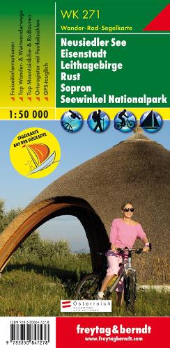
The Neusiedler See hiking, cycling and leisure map shows the area around Eisenstadt, the Leitha Mountains, Rust, Sopron and the Neusiedler See - Seewinkel National Park on the ideal scale of 1:50,000. It is the perfect topographical map for hikes, bike tours, sailing and excursions in the Seewinkel. The hiking map Neusiedlersee (WK 271) offers: Hiking and long-distance hiking trails Mountain bike and cycling tours Riding trails, Nordic walking trails Register of places with postcodes leisure info GPS-Infos sailing map The enclosed information booklet contains a selection of the best hiking trails, cycle paths and mountain bike routes as well as a brief description of the individual communities and their leisure activities. (Language: German). The back of the chart offers a sailing chart with nautical information. Long-distance hiking trails: 01 Northern Alpine Trail, 02 Central Alpine Trail, 07 Grenzlandweg, Burgenland long-distance trail, Lower Austrian circular hiking trail, Bernstein Trail, Marienweg, Via Sancti Martini - Martinusweg, Jakobsweg. Cycle trails: Lake Neusiedl cycle path, Leithara cycle path, cherry blossom cycle path, Lacken cycle path, Danube ? Neusiedler See connecting cycle path, Hanságradweg, culture cycle path, Kogel cycle path, anniversary cycle path, Lange Lacke cycle path. Environment maps: WK 013, WK 023.
Product Information
Product Information
Shipping & Returns
Shipping & Returns
Description
freytag & berndt maps are available for many countries and regions in the world. In addition to the precise cartography each map also includes a lot of additional information about the region covered.
The Neusiedler See hiking, cycling and leisure map shows the area around Eisenstadt, the Leitha Mountains, Rust, Sopron and the Neusiedler See - Seewinkel National Park on the ideal scale of 1:50,000. It is the perfect topographical map for hikes, bike tours, sailing and excursions in the Seewinkel. The hiking map Neusiedlersee (WK 271) offers: Hiking and long-distance hiking trails Mountain bike and cycling tours Riding trails, Nordic walking trails Register of places with postcodes leisure info GPS-Infos sailing map The enclosed information booklet contains a selection of the best hiking trails, cycle paths and mountain bike routes as well as a brief description of the individual communities and their leisure activities. (Language: German). The back of the chart offers a sailing chart with nautical information. Long-distance hiking trails: 01 Northern Alpine Trail, 02 Central Alpine Trail, 07 Grenzlandweg, Burgenland long-distance trail, Lower Austrian circular hiking trail, Bernstein Trail, Marienweg, Via Sancti Martini - Martinusweg, Jakobsweg. Cycle trails: Lake Neusiedl cycle path, Leithara cycle path, cherry blossom cycle path, Lacken cycle path, Danube ? Neusiedler See connecting cycle path, Hanságradweg, culture cycle path, Kogel cycle path, anniversary cycle path, Lange Lacke cycle path. Environment maps: WK 013, WK 023.