West+E1063 Black Forest, Pforzheim - Basel
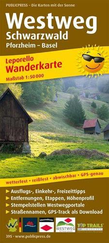
The Westweg Black Forest hiking map presents the 278 km long hiking trail of the same name between Pforzheim and Basel. Designed in a practical leporello style, it offers an overview on the first few pages:
The Westweg Black Forest hiking map presents the 278 km long hiking trail of the same name between Pforzheim and Basel. Designed in a practical leporello style, it offers an overview on the first few pages: The awards with the seal of quality 'Wanderbares Deutschland Quality Trail' and 'Top Trail of Germany' indicate natural subsoil, varied landscape and hiker-friendly gastronomy. The leporello fold of the Westweg Schwarzwald hiking map divides the high-altitude trail through the Black Forest, which requires physical condition, into small stages.
Product Information
Product Information
Shipping & Returns
Shipping & Returns
Description
The Westweg Black Forest hiking map presents the 278 km long hiking trail of the same name between Pforzheim and Basel. Designed in a practical leporello style, it offers an overview on the first few pages:
The Westweg Black Forest hiking map presents the 278 km long hiking trail of the same name between Pforzheim and Basel. Designed in a practical leporello style, it offers an overview on the first few pages: The awards with the seal of quality 'Wanderbares Deutschland Quality Trail' and 'Top Trail of Germany' indicate natural subsoil, varied landscape and hiker-friendly gastronomy. The leporello fold of the Westweg Schwarzwald hiking map divides the high-altitude trail through the Black Forest, which requires physical condition, into small stages.